The official website of Visit Ards and North Down
En

Slans Graveyard

Ardminnan Road, Cloughey, County Down, BT22 1QJ
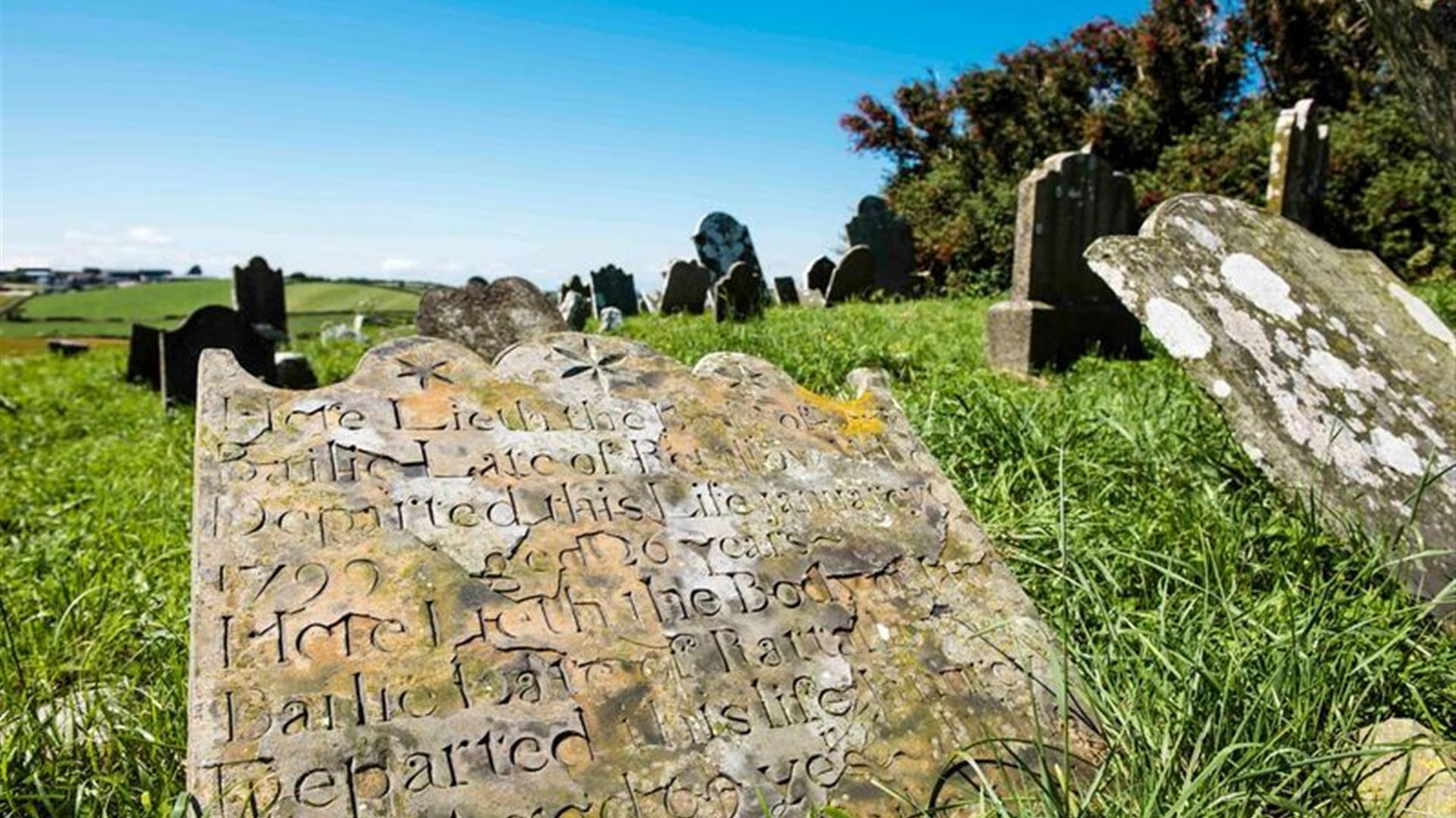
Close up photo of one of the gravestones, with others within view

Book Tickets Online

About

The graveyard is situated within a former rath, or ringfort, an enclosure of the first millennium A.D, and is surrounded by a white wall. Within it are the ruins of a medieval church which is believed to be the Church of Ardmacossce or Ardmacaisse, mentioned in the Taxation of Pope Nicholas, 1306 , along with an unusual cross-carved boulder. Aerial photography has indicated that the graveyard is in fact the nucleus of a much larger enclosure, which survives below ground in the surrounding fields.

At a time, it was the main graveyard for the Cloughey/Kirkistown area, and was also the burial place for many poor sailors who lost their lives on the notorious Cloughey rocks. The graveyard has an outstanding 360 degree view of the surrounding countryside and outside the wall there is a souterrain, approx. 50 metres in length which was quite accessible until recent years. The site is Scheduled for protection in recognition of its historic importance. 'Most of the oldest gravestones are of slate and the earliest readable date of death is 1677.

To access the graveyard, the 180m trail begins from the Ardminnan Road. Use the stone style and follow the fenced off corridor in the field to Slans Graveyard where you can explore the historic site and learn of its fascinating history from the interpretation panel.

Guide Prices

Ticket TypeTicket Tariff
TicketFree

Note: Prices are a guide only and may change on a daily basis.

Add Slans Graveyard to your Itinerary

Close window

Call direct on:

Tel+44 (0) 28 9182 6846

Map & Directions

Opening Times

* Accessible all year round.

What's Nearby

  1. On the coast, two thirds of a mile south east of Cloughey village. This house appears to…

    0.34 miles away
  2. Traditionally believed to have been built by Roland Savage of Ballygalget in 1622,…

    1.8 miles away
  3. Owned by the National Trust, it is a picturesque 18th century fishing village with scenic…

    2.22 miles away
  1. These ruined churches are situated one and a half miles north east of Portaferry on the…

    2.34 miles away
  2. Discover how Echlinville Distillery captures the flavour, colour and mouthfeel of their…

    3.71 miles away
  3. Situated on the hill south east of the town below the stump of Portaferry Windmill, a lay…

    3.73 miles away
  4. Portaferry Castle is a 16th Century tower-house, built by the Savage family. It is…

    3.82 miles away
  5. Enjoy a diver's view of marine life from around the world without getting wet. An…

    3.83 miles away
  6. The church at St Cooey’s Wells is thought to date from the 7th century but only the…

    4.78 miles away
  7. Burr Point, the most easterly point on the island.

    5.17 miles away
  8. Ballyquintin Nature Reserve includes Ballyquintin Point at the tip of the Ards Peninsula,…

    5.99 miles away
  9. Sketrick Castle is located on Sketrick Island which is reached by a causeway on the west…

    8.34 miles away
  10. A long sandy beach which offers enjoyment for all.

    8.43 miles away
  11. Grey Abbey, a Cistercian Abbey church and its living quarters were founded in 1193 by…

    8.73 miles away
  12. Nendrum is thought to have been set up by St Machaoi in the 5th Century and also has…

    8.74 miles away
  13. The Livingston Centre at Killinchy Parish Church is a local heritage centre. It tells the…

    8.8 miles away
Previous Next

Map & Directions

View Maps and Visitor Guides
View of what Ards and North Down has to offer and some of the best things to see and do during a visit.
E-newsletter sign up
Sign up for the Ards and North Down newsletter for inspiration and travel tips.
Back to Top

Tourism Northern Ireland

Don't Miss